A huge metropolis such as Santiago can feel oppressive to nature lovers. Once you’re done with Parque Metropolitano and its Cerro San Cristobal, you might end up pondering over your completo sandwich what to do next, your feet itching relentlessly in your hiking boots. Yet Santiago’s perfect location, between ocean and mountains, allows for several beautiful trekking escapes and hiking tours less than 2 hours away. So let’s explore them together!
This article about hiking day trips from Santiago contains affiliate links. We’re not selling anything ourselves – we just help products and services we find great. If you click one of them and decide to purchase, it’ll be at no extra cost to you; and we’ll get a trifle that’ll help us bring you more awesome travel guides.
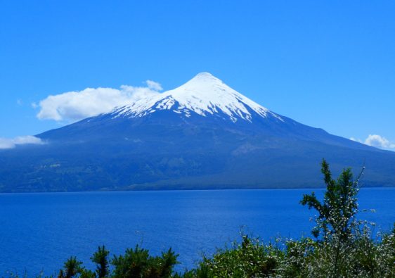
Cerro Manquehue

As you’ll see, there are many mountains near Santiago. Mount Manquehue is one of the favourite destinations for Santiaguinos looking for a day out. Its charismatic volcano shape, which is visible from almost anywhere in the city, has something magnetic to it.
The way up is rather steep, as you would expect from the mountain’s silhouette. Many pebbles on the dirt trails make them somewhat slippery. You might also have to climb up a few rocks before you reach the finish line and its magnificent view above the city.
This hike takes about half a day, but for a shorter and easier trekking option, Santiago has got you covered. Right next to it, Cerro Manquehuito is a smaller hill (hence the name). Both hills are rather busy on weekends, with families, pets and groups of friends hiking up and enjoying the view.
➔ Follow this trail on Wikiloc.
| Distance (time): | 6.5 km / 4 mi round trip (2 hours) |
| Difficulty: | easy to moderate ★★☆☆☆ |
| Best time to go: | All year round |
| Self-guided option? | Yes, or book a tour on Viator |
Cerro La Cruz (Parque Mahuida)

Isn’t it great that such a large metropolis should be surrounded by so many green areas? And many are accessible with public transport. Another one of them is the small Park Mahuida. It leans against the eastern flank of the city, right at the end of Alcalde Fernando Castillo Velasco avenue.
It’s therefore a busy strolling area with a tiny entrance fee (500 CLP for pedestrians as of May 2023). The highlight for a relaxing day out is the welcoming Bahá’í Temple, its curvy architecture and meditative gardens. But if your feet itch, leave the crowd behind and prepare for a full day hike up Cerro La Cruz.
The ascent is steep at times and several parts require rock scrambling. But your main enemy will be the sun and the lack of shades. So make sure you bring protection and enough water. At the end of a long zigzag to the top, you’ll be rewarded with a magnificent view on the mighty peaks all around, and the nearby Aguas de Ramón Park.
➔ Follow this trail on Wikiloc.
| Distance (time): | 15 km / 9.5 mi (6 hours) |
| Difficulty: | moderate ★★★☆☆ |
| Best time to go: | All year round |
| Self-guided option? | Yes, or book a tour locally |
Back to the city? Here are our favourite things to do in Santiago.
Salto de Apoquindo (Aguas de Ramón Park)

Still located within the Metropolitan Region, about a 1-hour drive away from the city centre, Parque Natural Aguas de Ramón is great if you want to go trekking near Santiago without dealing with slopes. It offers three different trails to explore its open land:
- “Canto del agua” is an environmental education trail. It’s therefore an easy, family-friendly, 30-min stroll along the estuary, with info panels and picnic areas.
- “Los Peumos” is a medium, 3.5-hour circular trail, that leads to two main viewpoints and a cheeky waterfall.
- “Salto de Apoquindo” is the longest and most challenging of the three, but not too challenging either. It’s an 18-km (11-mi) uphill walk that leads you straight to a 30m-waterfall.
The longer you walk, the more chance you get to spot local wildlife, including foxes, tarantulas (yikes!) and various birds. With clean and signposted trails, this natural park really does a great job as an environmental information centre for the residents of the capital.
➔ Follow this trail on Wikiloc.
| Distance (time): | 18.5 km / 11.5 mi round trip (7-8 hours) |
| Difficulty: | moderate ★★★☆☆ |
| Best time to go: | March–May (for the autumn colours) |
| Self-guided option? | Yes, or book a tour locally |
A bit further to the east, closer to San Carlos de Apoquindo Natural Park, towers the mighty silhouette of Cerro Provincia at 2750 m (9022 ft). There are two entry points to this trail, one at Puente Ñilhue and the other one near the UC stadium. Both can be reached by public bus.
Either way, it’s a 9 km (6 mi one way) climb that can be done within a day, or with an overnight option near the summit. In that case, you’ll enjoy a wonderful nightly view of Santiago, all dressed up in lights. Here’s the Wikiloc trail to get you going!
Cerro Pochoco
One more Santiago classic, Mount Pochoco is yet another of those gorgeous precordillera peaks – meaning the first line of mountains, before reaching the nitty-gritty of the Andes. It’s close, very close to the city’s last houses, in a neighbourhood named Lo Barnechea. So expect company on the trails.
Pochoco towers at 1804 m (5918 ft) above sea level, and its slopes are much steeper than its neighbours’. The trail is well marked and easy to follow but involves some rock scrambling; it’s physically demanding but only of medium difficulty.
Warning though: here again, the vegetation is scarce and the water sources non-existent. So here again, we recommend bringing enough water, and starting early to avoid the heat. From its summit, you’ll see Santiago like never before…
➔ Follow this trail on Wikiloc.
| Distance (time): | 6.5 km / 4 mi round trip (3 hours) |
| Difficulty: | moderate ★★★☆☆ |
| Best time to go: | All year round |
| Self-guided option? | Yes, or book a tour locally |
San Francisco Glacier (Maipo Canyon)

Many Santiaguinos love going on a day trip to the Cajón del Maipo, known as the ‘green lung’ of the Santiago metropolitan area. They find there many activities for the whole family: swimming, rafting, ziplining, hiking, horse riding, etc.
Several hiking trails are available, leading through a stunning landscape of mountains, volcanoes, forest, river, and even glaciers. We’re only a couple of hours away from the capital but already in the Andes mountain range – and it shows.
The El Morado Natural Monument hosts the popular San Francisco Glacier Trek (also known as El Morado Glacier trek), near the hamlet of Baños Morales –which is known for its hot springs. It’s a constant but moderate ascent, well signposted. On the way, Laguna Morales is a great spot to rest.
➔ Follow this trail on Wikiloc.
| Distance (time): | 16 km (10 mi) round-trip (4–6 hours) |
| Difficulty: | moderate ★★☆☆☆ |
| Best time to go: | October–May |
| Self-guided option? | Yes, or book a tour on Viator |
If you want to spend more than a day in these wonderful surroundings, you’ll find accommodations and camping places. In that case, we recommend hiking to the Mirador de Los Cóndores.
It’s a moderate 4-hour round hike, with a steep climb at the end. The trail isn’t perfectly sign-posted but easy to follow, just a tad slippery. It’s good to start off early so you get a chance to spot the mighty condors. Here’s the Wikiloc trail so off you go!
Cascadas de las Ánimas / Colibrí (Maipo Canyon)
Another one of the many hiking options in Cajón del Maipo is this family-friendly trail that leads to not one but two pretty waterfalls: Cascada de las Ánimas (Souls Fall) and Cascada del Colibrí (Hummingbird’s Fall).
It can be interesting to hire a guide for this easy hike, in order to learn more about the fauna and the flora of the area. That’d turn a day hike in somewhat of an environmental education trail, which is great if you travel with kids.
Since it’s part of a protected sanctuary, there’s a small fee to enter the area. Your donation will help the rangers take care of the ecosystem and a few endangered species, including several specimens of pumas.
➔ Follow this trail on Wikiloc.
| Distance (time): | 1.5 km / 1 mi one way (40 minutes) |
| Difficulty: | very easy ★☆☆☆☆ |
| Best time to go: | All year round |
| Self-guided option? | Yes, or book a day tour locally |
Cajón del Maipo is part of our favourite day trips from Santiago
La Campana National Park

Halfway between Santiago and Valparaíso –about 1.5 hour from either city– lies a peaceful coastal mountain range, with hilly forests and (many) palm trees. La Campana (meaning “the bell”, after the shape of its hill) offers a unique view of both the Andes mountains and the Pacific ocean.
As in most protected areas, there are several trails of different lengths and difficulties. A short and easy one brings you to a family-friendly waterfall, with a picnic area in the shade.
Another interesting trail is the full traverse, from the entrance at Olmué to the Portezuelo de Ocoa mountain pass. It’s only moderately difficult but equals a full day out, so make sure you bring your lunch and enough water. You’ll find shops in the small town of Olmué.
Find all the info (map, fees and opening times) and book your entry online on the CONAF site (in Spanish).
➔ Follow the waterfall trail or the full traverse.
| Distance (time): | 7 or 11 km / 4.4 or 7 mi (2 or 6 hours) |
| Difficulty: | fairly easy ★★☆☆☆ |
| Best time to go: | March–May (for the autumn colours) |
| Self-guided option? | Yes, or book a tour on Viator |
If you’re not tired of mountains yet, a good alternative for a day hike in La Campana is the ascent up Cerro el Roble. The round trip takes about 6 hours and is rather easy, provided you don’t mind a bit of rock scrambling.
The two advantages, compared to the traverse, is 1) coming back to your starting point, and 2) the greater elevation gain, which gives a view of the surrounding mountains that is absolutely priceless. By clear weather, you’ll see the ocean on one side and the tip of Mount Aconcagua on the other. Interested? Here’s the trail on Wikiloc.
La Campana is definitely one of the best national parks in Chile
Lago Peñuelas National Reserve

This is a beautiful national reserve south of La Campana (see above), surrounding a freshwater lake which aliments the taps of Valparaíso and Viña del Mar. It proposes several short and easy trails for everyone to enjoy a day out in the nature.
The hike we recommend lasts a full day but is fairly flat from the start to the end. You’ll be following countryside paths in between fields, up low hills and through forests. It’s a beautiful rural experience to break away from Santiago’s hustle and bustle!
The entrance fee as of May 2023 is 7,000 CLP. Besides the calm and the fresh air it provides, it’s also a great place for birdwatchers. With a bit of luck, you’ll be able to spot even some elusive South American fox or Pampas cat.
➔ Follow this trail on Wikiloc.
| Distance (time): | 46 km / 28.5 mi (9 hours) |
| Difficulty: | easy ★☆☆☆☆ |
| Best time to go: | All year round |
| Self-guided option? | Yes, or book a tour locally |
Since you’re here, have a look at what to do in Valparaíso on a budget
La Paloma Glacier trail (Yerba Loca)

Located 35 km from Santiago, this protected area follows the flow of the Yerba Loca river, or “crazy herb”. It’s one of the best places in the area for ice climbing, and there are also several gorgeous hiking options. Both the “Mirador del águila” and “Meseta los cóndores” trails make for beautiful day hikes.
For a longer walk, pack your tent, a cooker and enough water for a 2-day trek to the Paloma glacier. This well signposted hike takes about 9 hours, spending one night in a campsite. It’s not particularly steep nor difficult; just the heat can make it fairly challenging.
Although this green area isn’t the closest to Santiago, it usually gets crowded on weekends and during the school holidays, in December, January and February. You’ll need to buy a ticket beforehand on this website (in Spanish).
➔ Follow this trail on Wikiloc.
| Distance (time): | 31 km / 20 mi (9+ hours) |
| Difficulty: | moderate ★★★☆☆ |
| Best time to go: | avoid December–February |
| Self-guided option? | Yes, or book a tour on Viator |
Cerro Pintor
At 4,200 m (13,780 ft) above sea level, the “Painter” is the highest peak in this list. The trail to reach its summit is therefore the most demanding, and the view the most beautiful. In fact, mountaineers often train on Pintor before tackling higher, even more challenging summits in the area.
Rising on the other side of the Yerba Loca mountain range, the distance and the difficulty make the trail fairly quiet. But a trek at this height incurs some risks. It’s therefore important to:
- acclimatise on the previous day and to walk slowly, so as to reduce the effects of the altitude sickness;
- drink a lot (of water, not Pisco!) before and during the hike;
- use sun protection (hat, sunglasses and sunscreen);
- use walking sticks, and possibly crampons in winter, in case of snow or ice.
➔ Follow this trail on Wikiloc.
| Distance (time): | 14.5 km / 9 mi round trip (5.5 hours) |
| Difficulty: | challenging ★★★★★ |
| Best time to go: | All year round |
| Self-guided option? | Yes, or book a tour on Viator |
Río Los Cipreses National Reserve

Cypress River could have been the name of a rap group. Instead, it’s a beautiful protected area near the town of Rancagua, roughly a 1-hour drive south of Santiago. The lower elevations host Valdivian forests, common in Central Chile; by climbing higher, you reach the shrubs that are typical to the Andean steppe.
If you’re in for an extreme, Into-The-Wild kind of experience, there’s an easy but long (25-km / 15.5-mi, 3 days) trail to a mountain refuge. Good luck with that and tell us how it went – we’re genuinely interested.
For a more accessible experience, better tackle the 19 km (12 mi) path in the Los Maitenes sector of the park. It leads to a roaring waterfall, through a lovely shrubland dotted with streams and orchids, and some charismatic rock formations.
➔ Follow this trail on Wikiloc.
| Distance (time): | 19 km / 12 mi (5 hours) |
| Difficulty: | easy ★☆☆☆☆ |
| Best time to go: | All year round |
| Self-guided option? | Yes, or book a tour locally |
★
Are you ready to go trekking near Santiago? Which trail did you choose?
Tell us in the comments below!


This really answered my question about where to go for a nature day trip outside of Santiago, thank you!