Honestly, it would be a crying shame to travel through Colombia and never venture out of town. The country hosts about 10% of the planet’s biodiversity, ranking second in the world (after Brazil); even earning the sexy-sounding adjective of ‘megadiverse’. It’s a real treasure trove for nature enthusiasts, wildlife lovers and hardcore hikers alike. So from the desert to the rainforest, down volcanoes and along the turquoise sea, let’s explore 11 Colombia hikes, that rank among the most beautiful hiking trails.
This article about Colombia hikes contains affiliate links. We’re not selling anything ourselves – we just help products and services we find great. If you click one of them and decide to purchase, it’ll be at no extra cost to you; and we’ll get a trifle that’ll help us bring you more awesome travel guides.
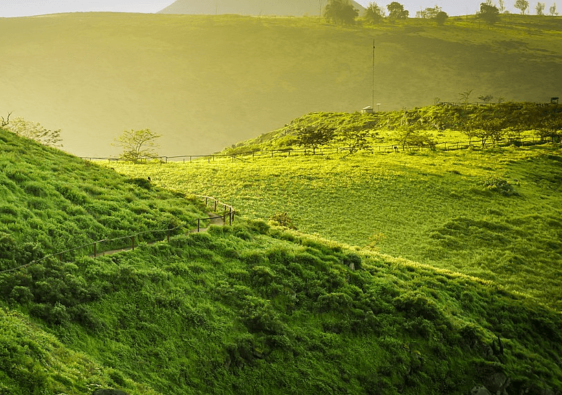
Tayrona National Park Hike

Parque Nacional Natural Tayrona is a jewel of protected tropical forest stretched along the turquoise Caribbean sea. Yes, do expect golden beaches of fine sand, warm and gentle waves, and iconic palm trees.
But beside the cliché Caribbean beach life, there’s plenty of room in the park for some proper adventure. A network of sandy trails and wooden boardwalks follow the coast and dive into the forest; going up and down boulders, up to stunning viewpoints, and emerging from the forest directly onto empty beaches.
The entrance fee might be steep, but there are several cheap campsites, where you can stay as long as your food reserve lasts. Most visitors only go there to enjoy the beaches for one day or two; so you’ll have the trails primarily for yourself. Beware though, some areas are considered sacred by the local people, and are therefore out of bounds. These are marked on the map you’ll be given when you get in.
➔ Follow this trail on Wikiloc.
Keep planning: All you need to know before camping in Tayrona Park
| Distance (time): | 8km (5 miles) one way, 2 hours |
| Difficulty: | easy ★☆☆☆☆ |
| Closest town: | Santa Marta |
| Best time to go: | July–September |
| Self-guided option? | Yes, or book a tour on Viator |
Ciudad Perdida Trek (Lost City Trek)

The Lost City Trek (Ciudad Perdida in Spanish), is a unique 4-5 day adventure through the jungle, rivers and hills of the Sierra Nevada de Santa Marta. It leads to the ruins of an ancient city that was abandoned during the Spanish conquest. After being rediscovered in 1972, it’s now a unique and exciting destination for hikers who want to feel like modern Indiana Joneses.
The trek cannot be done independently but must be arranged through one of several local companies based in Santa Marta. Choose an indigenous guide, so they can teach you about their history and traditions. You’ll get a deeper understanding of the centuries-old stone terraces and carvings you’ll pass on the way.
It’s certainly challenging but rewarding, as you’ll dive into both the thick forest and the culture of the continent’s early inhabitants. The spectacular view of the city from the highest point is truly an unforgettable sight.
| Distance (time): | 47 km / 29 mi (4 days) |
| Difficulty: | challenging ★★★★★ |
| Closest town: | Santa Marta |
| Best time to go: | December–February or March–April |
| Self-guided option? | No, so book a tour on Viator |
The Lost City Trek is among our favourite treks in South America
If your legs are rested and you have one more day in the area, don’t miss the hippy haven of Minca. Besides foreign tourists and overpriced falafels, this little jungle village offers a fantastic day hike adorned with cloud forest and waterfalls: the Los Pinos Trek.
The moderately difficult hike loops on 20 km / 13 mi (about 6 hours) through the vegetation. Its two refreshing pitstops are the very pretty Marinka waterfalls, and the cosy Pozo Azul, where the river creates a natural bathtub.
El Púlpito del Diablo (Devil’s Pulpit) Trail
This hiking trail brings you to one of the remotest parts of Colombia, near the border with Venezuela. It’s a land of alpine tundra (“páramo“), charismatic Andean peaks and mountain glaciers and lakes. It’s cold and wild and rugged, far from the image we usually have of Colombia.
The hike itself isn’t particularly demanding as a day trek, but you’d best be prepared. With the health risks caused by the altitude (up to 4765m / 15,633ft here) and the lingering presence of the armed guerrilla, this isn’t your regular Sunday stroll. You’ll have to hire a guide in the nearby town of El Cocuy. If that doesn’t sound like adventure, I don’t know what does.
But then, when the trail takes you to the edge of a shining glacier, with the spectacular Devil’s Pulpit monolith towering over you like the warning of an ancient god, you’ll forget the headache and the sore legs.
| Distance (time): | 22 km / 13.7 mi round trip (12 hours) |
| Difficulty: | moderate ★★★☆☆ |
| Closest town: | El Cocuy |
| Best time to go: | December–February or June–August |
| Self-guided option? | No, so book a tour in town |
El Camino Real: Barichara–Los Santos

The “Caminos reales” (Royal roads) of Colombia are a network of historic pathways of different origins. Some date from before the Spanish conquest; as is the case with the Barichara–Los Santos section, probably the most popular among hikers.
You’ll wind your way in ancient footsteps, walking from village to village, going down a canyon and up a mountain, crossing a footbridge. Parts of the road are paved, others are grass or dirt, but all is reasonably wide and well-marked.
It’s easy to plan your own Camino Real hike according to the time at your disposal. Most people walk only from Barichara until the village of Guane, which takes a couple of hours. For a 1-day trip, push to the placid hamlet of Villanueva (15 km / 9.3 mi), where you can spend the night before travelling further in the country. The full section until Los Santos takes 2 to 3 days. It’s also possible to do it in the other direction.
➔ Follow this trail on Wikiloc.
| Distance (time): | 30.5 km / 19 mi one way (2 days) |
| Difficulty: | easy ★☆☆☆☆ |
| Starting point: | Barichara |
| Best time to go: | Dry seasons December–February and July–September |
| Self-guided option? | Yes, easily |
Keep planning: All our tips to go backpacking in Colombia
Cueva del Esplendor (Cave of Splendor) Trail

A covered trail along a small stream through the lush mountains of Colombia’s coffee region, anyone? A refreshing waterfall powering through a rock and forming a pool in a cave?
If all that sounds delightful, you’re in the right place. This natural wonder awaits at the end of a moderately difficult hike, which is as enchanting as the site itself. When the mist opens up around the vegetation to reveal the cave’s opening in a tall rock face, it triggers a feeling of primeval satisfaction.
Guided tours can take you on a Jeep ride to the trail’s head, which is located north from the small and colourful town of Jardín. They provide arepas and coffee, so you might even start speaking Colombian. Yet it’s also possible to get there on your own, if you don’t mind climbing a few more miles up the mountain before starting one of the best day hikes in Colombia.
➔ Follow this trail on Wikiloc.
The well-named Cave of Splendor is one of our favourite South American waterfalls.
| Distance (time): | 23 km / 14 mi (7 hours) |
| Difficulty: | moderate ★★★☆☆ |
| Closest town: | Jardín |
| Best time to go: | Dry seasons December–February and July–September |
| Self-guided option? | Yes, or book a tour in Jardín |
Cocora Valley Hike

The Cocora Valley, within Los Nevados National Park, is a popular hiking destination for both national and foreign visitors, who want to admire Colombia’s national tree. Balancing overhead at 60 m / 200 ft, the Quindío wax palm is simply the world’s tallest type of palm tree.
It dominates a cosy panorama of farmlands and cloud forest, with horses and cows roaming about. Unless you have a car, you’ll get there with a 40-min ride on a Willy Jeep from Salento’s main square.
Although the area is touristy, it’s easy to do the hike independently and in relative solitude. The path is well-marked and fairly undemanding, although rain often makes the terrain muddy and much harder to navigate. It might be best to avoid the wet season.
The whole loop takes 5-to-6 hours and costs a total of 7000 COP. If you’re short on time or money, a quick dip in the valley will spare you 4000 COP and takes about an hour.
➔ Follow this trail on Wikiloc.
| Distance (time): | 13 km / 8 mi (5 hours) |
| Difficulty: | easy ★☆☆☆☆ |
| Closest town: | Salento |
| Best time to go: | Dry seasons December–February and July–September |
| Self-guided option? | Yes, or book a tour on Viator |
Further reading: Explore the most beautiful National Parks in Colombia.
Not far from here, the Nevado del Tolima trek is a challenging, 58.5 km / 36.3 mi (three days) round trip that goes up one of the region’s highest summits (5200 m / 17,060 ft). The steep climb leaves a landscape of wax palms for one of frailejones plants, typical of the Andean tundra.
Only experienced climbers with proper gear are allowed past the snowline, which lies at around 4600 m / 15,091 ft. That lucky lot will be rewarded with glaciers, mountain lakes, and the perfect shape of the Tolima crater.
La Chorrera Waterfall
We don’t have to be hardcore hikers all the time, so this one is a cosy half-a-day trip from Bogotá. Located a mere 2-hour drive from the chaos of the capital, it plunges into a cloud forest, graced with bromeliads and the soothing tweeting of birds.
The path is well marked, making for a lovely stroll in the forest. Families come here to take refuge from the pollution of Bogotá and the distant roar of the car horns.
Yet the final sight on this hiking trail is quite the thrill, since Cascada La Chorrera is nothing less than Colombia’s highest waterfall, with 590 m (1935 ft) divided in seven steps.
➔ Follow this trail on Wikiloc.
| Distance (time): | 6.4 km / 4 mi (3 hours) |
| Difficulty: | easy ★☆☆☆☆ |
| Closest town: | Bogotá |
| Best time to go: | All year round |
| Self-guided option? | Yes, or book a tour on Viator |
Fan of waterfalls? Discover the most radiant waterfalls in South America
Tatacoa Desert Hike

Blazing sun, western-movie-style cacti and the blurry line of the horizon. This is some high-class desert for sure. Add to this some crazy rock formations in red and white and grey.
This desert, in fact, looks like one that has been put together for a film screening; it’s relatively small and really stands out from the surrounding area. Walking inside the rock formations and reading how they formed is pretty neat. Some parts of the trail might be crowded with visitors, while others will be empty; in any case, it’s important to stay on the trail so as not to damage the landscape.
There are 2 distinct parts in the desert and they’re at some distance from one another: one with the red rock formations, and the grey part with a natural pool! Tuk-tuks can bring you to the furthest point and back for a flat rate.
➔ Follow this trail on Wikiloc.
| Distance (time): | Various distances |
| Difficulty: | easy ★☆☆☆☆ |
| Closest town: | Neiva |
| Best time to go: | June–August |
| Self-guided option? | Yes, or book a tour on Viator |
Keep planning: Tatacoa is part of our recommended Colombia itinerary
Puracé Volcano Trek

Located about three hours from Popayán, Puracé National Park is a hidden gem for adventure seekers, hikers and nature lovers. It’s one of Colombia’s most important ecosystems, offering a diverse landscape of trickling streams, waterfalls, mountains, plains and rocky formations; with a mixed fauna and flora, including the world’s largest bird, the mighty Condor.
Although it lies within the community-managed Kokonuko Indigenous Reserve, you can explore the park without a guide. It’s fairly remote, mind you, and reaching it can be a challenge due to Colombia’s unpredictable bus schedules.
Climbers who want to tackle the ascent to the crater of Volcan Puracé (4650 m / 15,255 ft) will need to hire a local guide and be properly prepared. The reward is a misty scenery of rocky outcrops and green shrubland surrounding the enormous crater. Plus it’s the only active volcano that hikers are allowed to climb in Colombia, so add that to your CV.
➔ Follow this trail on Wikiloc.
| Distance (time): | 14 km / 8.7 mi (7 hours) |
| Difficulty: | challenging ★★★★☆ |
| Closest town: | Puracé (Popayán) |
| Best time to go: | Dry seasons December–February and July–September |
| Self-guided option? | Yes for the park. For the crater, book a tour on Viator |
Fan of volcanoes? Discover the Quilotoa crater lake, in Ecuador.
Fin del Mundo (End of the World) trek
Believe it or not, the thick Amazon jungle is full of amazing waterfalls. Near the Southern town of Mocoa, the pretty fall known fondly as the ‘End of the World’ splashes away like there’s no tomorrow.
This short and easy hike doesn’t bring you to one but to four different waterfalls, scattered along the river. These four falls are some of the most peaceful you’ll ever visit. They pleasantly splatter into deep green swimming holes warmed by the sun.
Then, upon reaching the 70-metre-tall ‘End of the World’ fall, closely surrounded by the lush vegetation, you quickly understand the meaning of its name. It does feel like you’ve reached the end of something, which is most likely a new inner beginning.
➔ Follow this trail on Wikiloc.
| Distance (time): | 6 km / 3.7 mi (2 hours) |
| Difficulty: | easy ★☆☆☆☆ |
| Closest town: | Mocoa |
| Best time to go: | All year round |
| Self-guided option? | Absolutely |
Mavecure Hills

These three giant rocks are situated along the Inírida River, a couple of hours from Puerto Inírida, near the Venezuelan border. The town is only accessible by plane, then a boat must take you up river. Comparatively, the short hike up the rocky slope is a walk in the park.
According to the legend, those three brothers are named Pajarito (the tallest, standing at 712 m / 2,366 ft), Mono (480 m / 1,570 ft), and Mavicure (the shortest at 170 m / 560 ft).
Pajarito is imposing, with multiple slopes and ridges, while Mono looks like a dome with carved lines down its sides. Mavicure seems to be the friendliest among them; relatively easy to climb, a forest grows on its slopes like a leafy necklace adorning its monolithic summit.
This geological formation is part of the Guiana Shield, and date to more than a billion years before the dinosaurs. All around, the thick Amazon jungle covers the horizon, while a brown river serpents in-between.
➔ Follow this trail on Wikiloc.
| Distance (time): | 170 m / 560 ft (1 hour) |
| Difficulty: | Easy to moderate ★★☆☆☆ |
| Closest town: | (Puerto) Inírida |
| Best time to go: | August–October |
| Self-guided option? | No, so book a tour on Viator |
★
Which of these trails do you feel like hiking in Colombia?
Tell us in the comments section below!


It would be great to do them all! But the Ciudad Perdida in the Santa Marta sierra, guided by a local person from the originary people sounds extremely inspiring! Great post with excellent practical info. 🙂
Great choice! Although it would be a shame to stop there and not do more hikes in Colombia. Thanks for stopping by!
How my, sooo looking forward to tackling some of these trails when I visit Colombia in January next year. Saving this post!
Hello Edrin, thanks for your message and we hope you enjoy the beautiful hiking trails that Colombia has to offer!
Great article, thank you very much! Very inspiring for my coming hiking trip to Colombia.