Of all the protected areas in the Chilean South, the Patagonia National Park might be the most charismatic. Created as a private charity project, it’s kept a pristine touch, almost a primeval flair. The infrastructure is scarce, but with a bit of prep, you’ll love exploring this mythical land. This post is here to help! We’re telling you all you need to know to go hiking in the Patagonia National Park, Chile: day hikes and multi-day treks, campsites, cost, how to get there and more.
This Patagonia National Park guide contains affiliate links. We’re not selling anything ourselves – we just help products and services we find great. If you click one of them and decide to purchase, it’ll be at no extra cost to you; and we’ll get a trifle that’ll help us bring you more awesome travel guides.
Jump to:
Hiking in Patagonia National Park:
Tamango | Jeinimeni | Chacabuco Valley
Multi-day hikes
How to get there | When to visit Patagonia National Park
Entrance price | Accommodation | Gear
What is and where is the Patagonia National Park
Parque Patagonia is the youngest national park in Chilean Patagonia, in the southern part of the Carretera Austral. It was established in 2018 by uniting two neighbouring natural reserves: Tamango (which included the Chacabuco Valley sector) and Jeinimeni. Locals still refer to these areas separately.
The result is a huge national park spreading over 3000 km2, offering various beautiful day-hikes and multi-day hiking trails of different lengths and of different difficulties. The two national reserves are separated by the X-83 road, that is adjacent to the Carretera Austral.
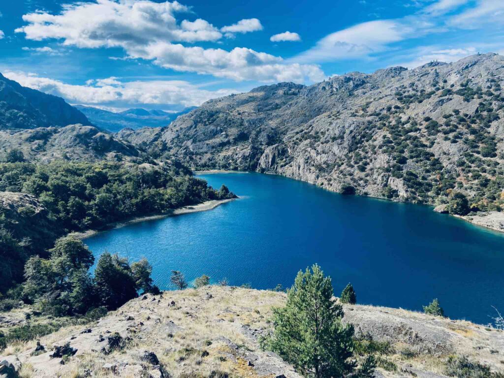
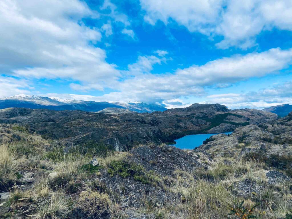
The landscape is a transition between the Patagonian steppe grasslands and Chilean beech forest, with extensive wetland areas as well. The Chacabuco Valley is dotted with turquoise lakes and rivers feeding from glaciers. If you’re lucky, you can meet guanacos, relatives of the llamas and alpacas, or the endangered huemul deer, Chile’s national animal.
Patagonia National Park is one of the highlights of a Patagonia backpacking trip. Check my other recommendations in the complete Patagonia backpacking guide.

Tamango Natural Reserve
Tamango is a beautiful, easily accessible piece of nature, at a walking distance from Cochrane town. It offers several easy hiking routes, plus a couple of more difficult ones. Its well-maintained paths among trees and shrubs encompass rivers, lakes, and towering mountain tops.
You can trek through a ñirre forest –a Patagonia native tree– along the refreshing river Cochrane; or choose a more challenging route around the Tamanguito mountain.
Jeinimeni National Reserve
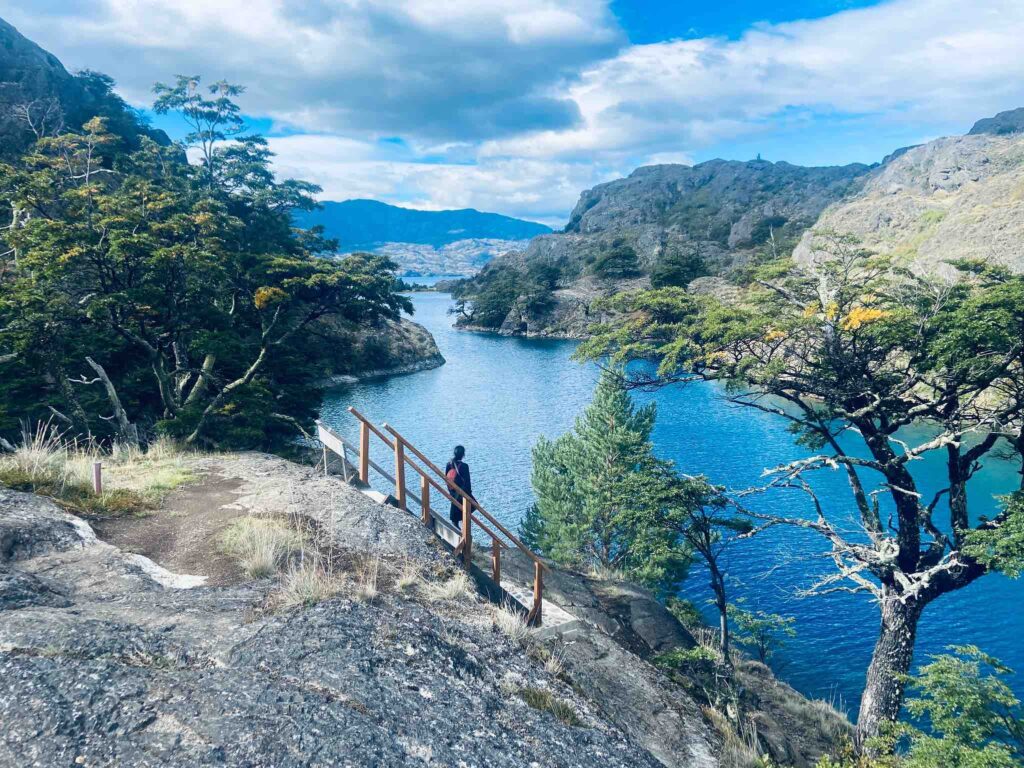
This part is located near the Argentinian border, north from Tamango and south of Chile Chico town. It got its name from its turquoise lake, Jeinimeni. It’s slightly less visited, as it’s more difficult to access – you’ll need a car, either a taxi or a rental car. However, there is more wilderness here, and hikers can experience backcountry trails with wild camping (which is usually forbidden in Patagonia).
Some of the most beautiful views in the Patagonia National Park are here, with lookouts to mountain lakes, rivers, and snow-capped mountains hugging Lake Jeinimeni.
Chacabuco Valley
This stunning valley is situated in between the Tamango and Jeinimeni sectors, on both sides of the X-83 road. It’s only accessible with a car and offers several day-hikes and one multi-day hike connecting to Tamango.
The most popular trek in Patagonia National Park, the Laguna Atlas trail, crosses this sector. Apart from campsites, there’s also a lodge and a restaurant.
Hiking in Patagonia National Park
As we said, the Park is divided into 3 sectors: Tamango (Cochrane Lake), Jeinimeni and Chacabuco Valley. There are plenty of day-hike possibilities in all three sectors.
Since the town of Cochrane is likely to be your base, we recommend focusing on the Tamango sector for your day hikes. If you have a car, indulge in multi-day hikes in the other sectors too.

Day hikes in the Patagonia National Park
Tamango
In Tamango, there are 10 hiking trails ranging from 1.3 km / 0.8 mi (45 mins) to 6.8 km / 4.2 mi (3 hours one-way). Naturally, these can also be combined.
Below are the trails indicated at Tamango visitors centre in 2022. All distances and times are one-way.
| #1 | Las Aguilas trail | 2.2km / 1.3 mi, 1hr 15mins, medium |
| #2 | Los Carpinteros trail | 4.6km / 2.8 mi, 2hrs, easy |
| #3 | Los Coigües trail | 3.9km / 2.4 mi, 2hrs, medium |
| #4 | Los Ciruelillos trail | 1.3km / 0.8 mi, 45mins, medium |
| #5 | Los Huemules trail | 6.8km / 4.2 mi, 2hrs, medium |
| #6 | Las Lengas trail | 4.8km / 3 mi, 3hrs, difficult |
| #7 | Los Valles trail | 4.6km / 2.8 mi, 2hrs, medium |
| #8 | Los Pumas trail | 4.2km / 2.6 mi, 3hrs, difficult |
| #9 | Los Condores trail | 3km / 1.8 mi, 2hrs, medium |
| #10 | Los Ñirres trail | 2.8km / 1.7 mi, 1hr, easy |
We hiked Los Carpinteros (#2 in the table), which is a leisurely trail along the Cochrane river. At one part it leads through a forest of ñirre, before reaching a lookout upon the beautiful Lake Cochrane.

Jeinimeni
Jeinimeni offers various day hikes around Lake Jeinimeni or in the Piedra Clavada area.
| #1 | Jeinimeni Lake lookout (Mirador Lago Jeinimeni) | 1.9km / 1.1 mi, 45mins, easy |
| #2 | Lagunas Atlas circuit | 20.4 km / 12.6 mi, 7hrs, difficult |
| #3 | Douglas Tompkins lookout | 13.5km / 8.3 mi, 4hrs, medium |
| #4 | Aviles trail | 17km / 10.5 mi, 5hrs, difficult |
| #5 | Piedra Clavada – Cueva de las Manos – Valle Lunar | 6.8km / 4.2 mi, 3hrs, medium |
| #6 | Laguna Esmeralda trail | 5km / 3.1 mi, 1hr, easy |
Keep dreaming: Discover our favourite National Parks in South America
Chacabuco valley
The Chacabuco valley hikes start at Casa de Piedra (north) or at Camping Los West Winds (south).
| #1 | Lagunas Atlas circuit | 20.4 km / 12.6 mi, 7hrs, difficult |
| #2 | Laguna de los Cisnes trail | 17km / 10.5 mi, 5hrs, medium |
| #3 | La Vega trail | 5km / 3.1 mi, 1hr, easy |
| #4 | Cañadón Chacabuco trail | 15km / 9.3 mi, 5hrs, medium |
| #5 | Los Gatos trail | 14.6km / 9 mi, 5hrs, difficult |
| #6 | Circuito Lago Chico | 13.5km / 8.3 mi, 4hrs, medium |

Multi-day treks in the Patagonia National Park
Each sector offers a single multi-day trek. For more info on each one, I recommend checking on AllTrails or Wikiloc. Furthermore, Mochilão Sabatico has detailed blog posts (in Portuguese) on the Travesia Jeinimeni and the Cerro Tamango – 7 Lagunas multi-day hikes.
Tamango
There’s a 2-day hiking trail in Tamango, which combines the Las Aguilas, Las Lengas, Los Valles, Los Pumas, and Los Huemules trails (#1 and #5–8 in the table).
It’s advised to do it clockwise, starting from Las Aguilas. It circles around the mountain and goes along the shore of the Cochrane lake. There’s no official campsite, but wild camping is allowed in the park.
Jeinimeni
The only one here is Travesia Jeinimeni – Valle del Aviles: 64km / 39.7 mi, 5 days, difficult.
Chacabuco valley
The multi-day hike in this sector is the Cerro Tamango – 7 Lagunas trail: 92km/ 57.1 mi, 6 days, medium.
Read more: the best multi-day hikes in Patagonia

Useful info about the park
How to get to Patagonia National Park
The Patagonia National Park lies 330 km / 205 mi south of Coyhaique, just off the Carretera Austral. The closest towns are Cochrane in the south, and Chile Chico in the north.
Cochrane is on the Carretera Austral. To get there, you can either travel north by bus/car from the direction of O’Higgins; or travel south by bus/car from Coyhaique / Balmaceda Airport.
Chile Chico is right at the border with Argentina, on Ruta 265, a side road from the Carretera Austral. You can reach it by bus/car traveling from the Carretera Austral or from Argentina.
Getting to Tamango park entrance
Tamango is easily accessible from Cochrane on foot (50 mins walk) or by rental car or taxi. There’s not much traffic on this side road, so hitchhiking might prove difficult.
Getting to Jeinimeni park entrances
Jeinimeni is further north from Cochrane, just south of Chile Chico, near the Argentinian border. The entrance is on the X-753 side road, so unfortunately it’s not accessible by walk or public transportation.
To reach Jeinimeni, you need your own/rental car, or to pay a taxi. There are 2 entrances from the X-753: Piedra Clavada (in the north), and Jeinimeni Lake (in the south).
Getting to Chacabuco Valley park entrances
Chacabuco Valley is between Tamango and Jeinimeni. The two entrances are at Casa de Piedra, and at Camping Los West Winds, both on the X-83 (a side road from the Carretera Austral). This sector is only accessible by car as well.

Entrance ticket
As for every other national park in Chile, you’ll need to buy an entrance ticket. For adult foreigners, count 9000 CLP as of January 2024, whatever the duration of your stay.
You can check the latest price, trail and camping info on the CONAF website (in Spanish). Buy your ticket in advance, or at the entrance.
Keep planning: Discover more National Parks in Chile

Accommodation
Camping
Within the park, the most popular accommodation is your own tent, either on official campgrounds or the occasional wild camping. Camping costs between 3000 CLP and 6000 CLP per person per night as of Jan. 2024. Before setting off, make sure to check the camping status on the CONAF website, as some might be closed.
In Tamango, the campsite is near the park entrance. In Jeinimeni and Chacabuco Valley, there are several campsites near the entrances – plan according to your route. Remember to always leave no trace and take all your rubbish back out.
Outside the park boundaries, there are also campsites in the towns of Cochrane and Chile Chico.
Hotels
Within the park, there’s only one lodge and restaurant, in Chacabuco Valley.
Apart from that, hotel and hostel accommodation is only available outside of the park. There’s plenty in both Cochrane (south) and Chile Chico (north).
Gear
Good hiking boots, a rain jacket, and a hat and sunscreen are all must-haves. Many trails lack in shade. Hiking poles would be a great help to climb hills and cross rivers.
Some paths are well-marked, some are a bit confusing, so I recommend downloading the trail on an offline map. My (free) go-to app is maps.me.
If you decide on a multi-day hike, you’ll need your own tent and all the necessary food. Because besides a restaurant in the Chacabuco Valley, there’s no shop nor restaurant within the park.
More tips: How to pack like a minimalist

When to go hiking in the Patagonia National Park
The park is open all year round. But during the winter season, temperatures drop and snow often limits the number of open trails.
The best time to visit the Patagonia National Park is considered to be between January and April, when the temperatures are more suitable for camping, there’s no snow, and all trails / campgrounds are open. Note that January–February is the Andean summer aka the high season, when the park is the busiest.
I personally prefer to travel in the shoulder season (March–April) to enjoy more solitude in the nature. However, bear in mind that with the end of the high season, services start closing: you might find less options in accommodation and public transportation.
Keep reading: Traveling along the Carretera Austral, Patagonia’s legendary road.
★
Ever gone hiking in the beautiful Patagonia National Park?
Share your story with us in the comments!